
More...
About:
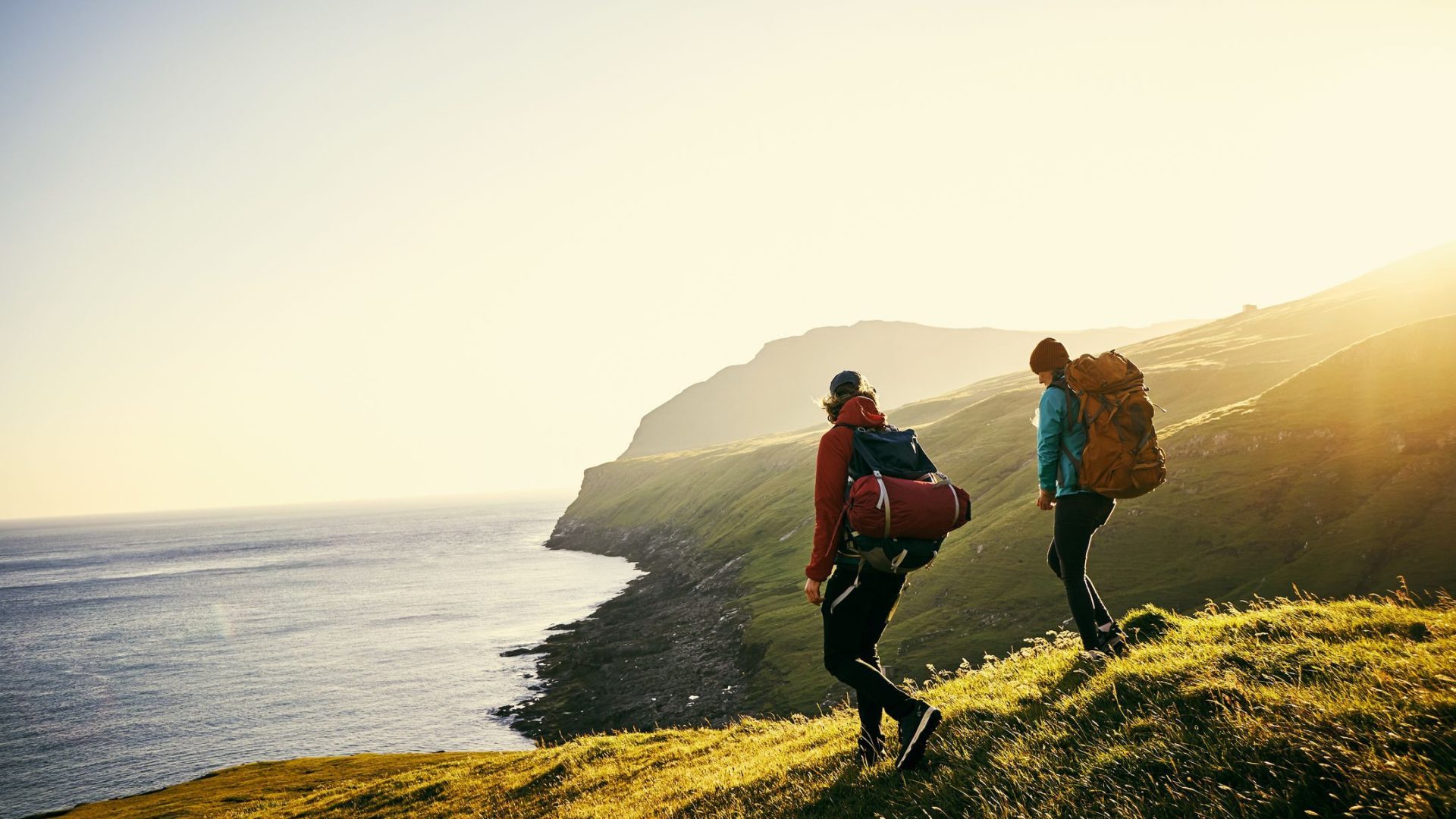
The village of Upperchurch is located near Thurles in Co. Tipperary and is twinned with the neighbouring parish of Drombane for many aspects of life including hurling (a traditional Irish sport played with sticks and ball). The community has been involved for many years in developing tourism products including hillwalking. The folklore of the area tells of a Robin Hood figure that roamed the hills of West tipperary in the 17/18th century – and was known as Eamonn a Chnoic (Ned of the Hill). His ancestors were extensive landowners, whose lands were confiscated and Eamonn a Chnoic became one of a band of raparees who championed the cause of the poor, dispossessed native and harassed the English planters. Many legends are told of these men and their deeds. This loop explores the area around Birch Hill – which may in times past have sheltered Eamonn and his ‘merrymen’!
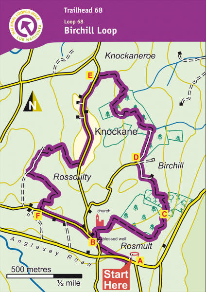
Routes
A-B. With your back to Dempsey’s Pub, turn right and follow the surfaced road to reach an old laneway in your right. Follow this laneway for 100m to rejoin a surfaced road and turn right. Almost immediately watch for a gateway into the Blessed Well on your right – turn right and enter the Blessed Well area.
B-C. From the back of the Blessed Well are, cross the stile and follow the arrows uphill to the walls of an old church/graveyard. Turn right
t and follow the purple arrows as the loop zig-zags its way through fields to enter forestry.
C-D. Follow the purple arrows through the forestry section and into open fields atop Birch-hill. After passing through some fields the loop exits onto a sandy roadway and turns left. Only 30m later you reach a 4-way junction where you turn right.
D-E. The loop now follows a forestry road for 300m before making its way through a mix of forestry and newly planted sections of birch. After approximately 1km (20 min) you exit forestry into a field. Follow the purple arrows around the edge of the field to onto roadway at a memorial to John Burke.
E-F. The loop follows a surfaced roadway for almost 1km through Knockane before turning right and entering a field. Following field boundaries the loop descends to reach an old roadway at Rossoulty. Here it turns left and, after only 200m, turns left again into another field. From here the loop climbs to reach a stile and then sweeps right to reach an old cart road from where it descends to exit onto surfaced road.
F-A. Turn left and follow the surfaced road for 800m to regain the Blessed Well (on your left). Pass the well area and turn left onto the old laneway to make your way back to the trailhead.
Directions to Trailhead
Start from the town of Thurles just off the national route N8 from Dublin to Cork. Take the R498 (signposted Nenagh) for 2.5km to reach a junction with the R503 (signposted Limerick). Follow the R503 for 11km to reach Dempsey’s pub on your right. [The village of Upperchurch is 2km further – watch out for crossroads with a stone name plate. Turn right and travel 500m to enter the picturesque village.